A week in Scotland in May 2009
After toiling away for seemingly ages with the PC, map's and phone we eventually had four ferry crossings booked along with lodgings in five different B&B's dotted around Scotland.
Our D day was set to be Sunday 10th May.
D day 10th of May
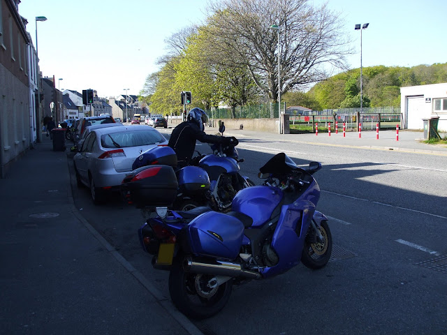
Awoke bright and early got ready and after loading the last minute items onto the bike. Said my goodbye's to Sandra and off I went. For the meet up at the Tickled Trout services at J31 of the M6 for about 6:00am.
John C arrived shortly after me and an important discussion then ensued regarding where we should stop for breakfast. T bay services was quickly decided upon.
The weather forecast had changed over the last couple of days and rain was now predicted for only the first 200 miles of the journey followed by clear skies north of that point (yipee), the forecast was more or less correct it was very cloudy and lightly raining but not too bad really. The strong gusting wind was the worst thing.
We joined onto the near deserted M6 and after an innitial blast of speed and a couple of bouts of overtaking each other with grins and finger/thumbs up signals etc we settled into a sensible cruising speed. A bit of light rain here and there during the trip to Tbay, where we stopped for a full breakfast. After which we continued onwards to Glasgow. We had intended to go through Glasgow on the motorway or fastest route but through some quirk with the Gps/rider interface a route was taken straight through the city street network.
I had not been into Glasgow before so it was summat new. A football ground here a ship yard there and plenty of shops and statues dotted about. But mostly way too many red lights which soon became very tedeous. At least it was dry though.
Eventually we got through the city and followed miles and miles of road lined down the one side with heavy gauge diamond mesh fencing topped with razor wire. After a while we reached the gates of the Naval base to which this fence belonged.
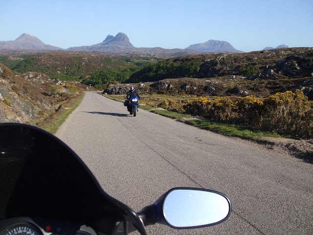
After the naval base the road opened up with plenty of curves and some quite sereous undulations in places that could leave you airborn on the entry into a bend. We followed the shore lines of the lochs wherever we could. Along the side of the loch we would go then round the top and part way down the other side, the road would then typicaly veer off at 90 degrees and cross country to meet up with the shore line of the next loch where the process would be repeated.
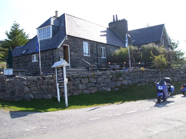
Eventually we reached Loch Long and as we travelled up the south easterly shore line we passed by a brightly painted diner that had a few bikes parked outside. We did a quick U turn as we hadn't stopped for the past couple of hours or so and the thought of coffee was sudenly virtually a matter of life and death. The diner was called The Pit Stop diner. The walls inside were festooned with interesting photographs and info about the war time history of Loch Long..for example:
During the war this loch served as a torpedo testing/firing range and an average of 48 - 68 torpedos were fired down the loch each and every single day.
In hind sight this route from Glasgow although different was not as 'awesome' as the route we took in 2007 straight up past Loch Lomand on the A82. If ever I go again I will either revert back to that route or experiment with a new route.
Our destination was the town of Mallaig, as this is where we were scheduled to catch the ferry at 15:30pm which would take us across to the southern end of the Isle of Skye.
After the coffee and scrambled eggs on toast we continued with our journey. The road towards Mallaig got better and better but we soon realised that there was no way we could make it intime for the ferry.

We pulled over and phoned the ferry ticket office with the news.
They duly re-scheduled our tickets. Eventually we arrived at Mallaig after traversing the best biking road we had seen in ages..... this road from Fort William to Mallaig is absolutely awesome, we zoomed along with grins from ear to ear and then a bunch of local reprobates reeled us in and screemed past us as if we were stood still.
We stopped at a 'fairly' scenic view point for a while then continued again for only a mile or so and found the reprobates stopped at an 'incredibly' scenic view point (local knowledge would have been a bonus to us).
Ah well, we boarded the ferry and set sail to Skye. The time was about 6:15pm.
We stopped at a 'fairly' scenic view point for a while then continued again for only a mile or so and found the reprobates stopped at an 'incredibly' scenic view point (local knowledge would have been a bonus to us).
Ah well, we boarded the ferry and set sail to Skye. The time was about 6:15pm.
 |
| Don't worry, that little boat is NOT the ferry. The pic is taken from the ferry |
The sea was like a mill pond as we left
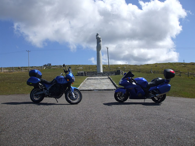
Upon arriving on the Isle of Skye we imidiately set about adjusting the chain on Johns Triumph as it was making a bad creaking noise due to being too tight. Suprising really as it was fully serviced and inspected at the dealers two days ago.
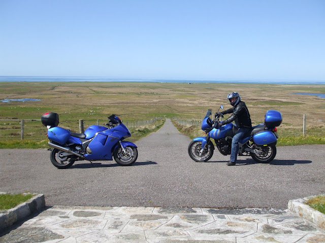
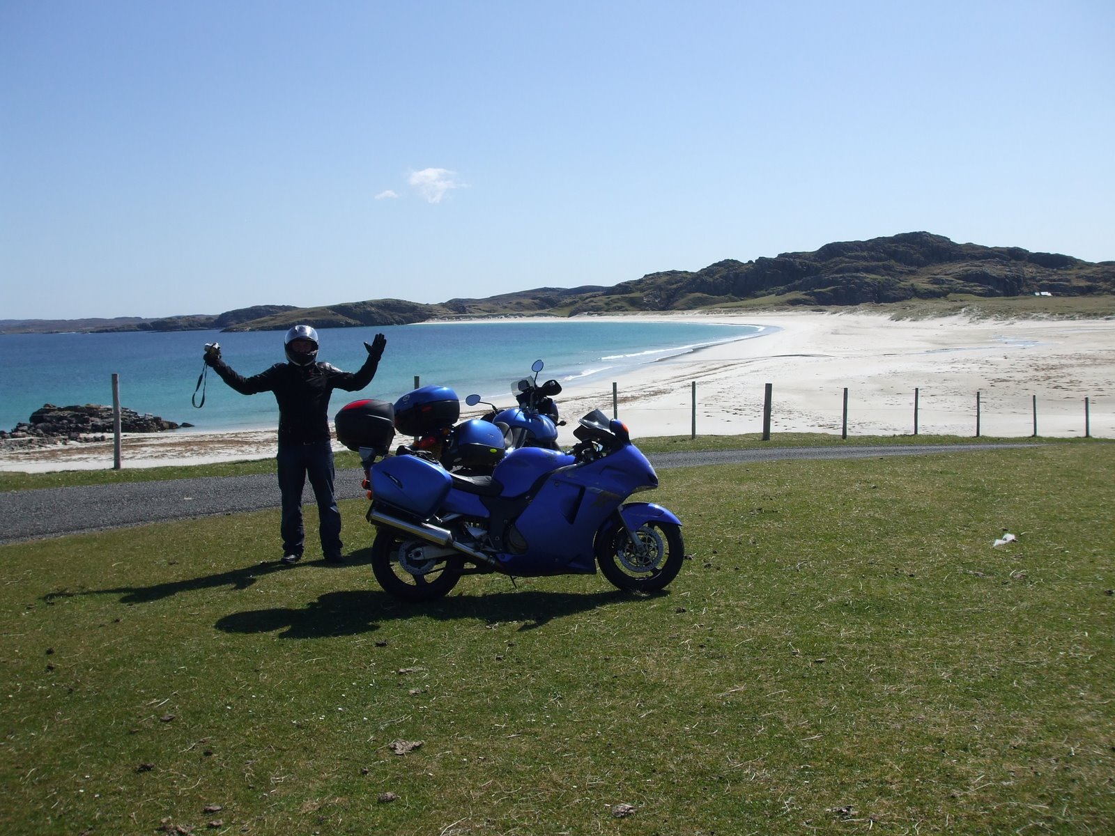
That done we set off in the direction of Uig, the place where our 1st nights B&B was situated. The roads on Skye were virtually deserted, it was a great ride to Uig. Prior to decending into the town we stopped on a hill overlooking Uig Bay and took a few photo's of the calmness of the sea and the setting sun. By now it was about 9:00pm and we had covered a leisurely 425 miles for the day.
 |
| Overlooking Uig Bay |
Unfortunately due to the 'late' hour 9:30pm, we had missed the cut off time for evening meals at all the local eateries so we consoled ourselves with a couple of bags of crisps and a couple of pints at the near by pub.
Day 2
Bright and early next day the proprietor brought us full cooked Scotish breakfasts which we greedily dispatched and shortly after that we bade them farewell and made our way to the queue for the ferry which was literally a hundred yards away from where we were.
We boarded the ferry which was much larger than the one that brought us to Skye the day before. After parking the bikes and watching as the attendants lashed them down to the deck we went up to sit in the glorious sunshine on one of the observation decks.
It was unbelievable how sunny a day it was, there literally was not a cloud to be seen. During the 2 hour crossing to Uist we took many photo's and speculated on what type of terrain would greet us on there.
It wasn't long before we landed at the North end of the island and we discovered for ourselves.
Innitially the land seemed quite flat as we headed off in a southerly direction. Incidentally we had to catch another ferry later in the day at a place called Bernaray (sp) which was also at the northern end of the island. That being the case it meant we didn't have much time for exploring Uist, maybe 5 hours tops?
We headed in a south westerly direction and tried to follow roads near to the coast whenever possible. As we headed further south the terrain became more hilly. At one point we saw an immaculately tarmaced side road heading off at 90 degrees to the left. We braked then followed it steeply up the hill, We went quite fast up this hill.... maybe 60 MPH as we passed the sentry boxes. Yep that's right ...sentry boxes. It turned out to be some sort of tracking station. There were a few geodesic domes at the top of the hill a bit like the ones at RAF Menwith Hill in Yorkshire. Anyway we stopped in the visitors car park at the top and noticed the signs forbidding the taking of photographs, hence no pic's.
The tracking station, pic taken from several miles away.
We soon hit the road again and went back down the hill at a more sedate speed in compliance with the posted limit. We half expected to be stopped at the sentry boxes, but luckily we breezed through.
Back on the main road again we travelled a bit further and saw another track to the left which out of curiosity we duly followed again, this took us up the same hill (but a bit further round) and to a religious type statue.
 |
| Oh look a cloud has appeared |
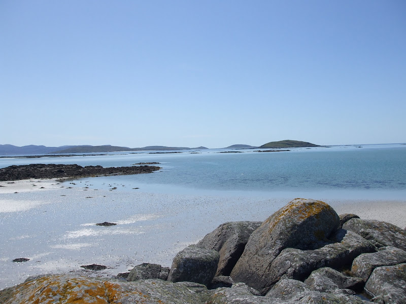
After a bit of a photo shoot we again continued southwards, ie. straight down that track and turned left. We wanted to get right to the coast to see what it was like. At the next junction we took a right turn, then onto a gravel track and across a field followed by a sandy track and finally across another field and lo and behold there was the beach and the sea or rather the North Atlantic to be more precise.

You dont see many people on the beaches here
Here's a picture of the typical shore line on Uist:
 |
| Taken near to the Eriskay Causeway |
The picture doesn't convey the almost over powering stench of rotting sea weed which seemed to prevail along this coast line of Uist. (have since been informed that it could have been seaweed used as manure on the fields)
Despite the stench it was great to stop occasionally and take in the sights and sounds of the beach or river or monument or whatever else and listen to the waves and cool off a bit. Mind you we couldn't stop too long or often due to our limited time.
We ventured as far south as we dared which was just the other side of the Eriskay Causeway. So technically we were on the Isle of Eriskay at the southern end of Uist where upon we did a U turn and headed back north again for our rendezvous with the ferry at Bernaray in the north of the island.
Despite (or rather because of) our fear of missing the boat we were the first to arrive at Bernaray in readiness to cross to the Isle of Harris. The ferry was already in position at the end of the loading ramp and was holding station with the help from it's engines against a very strong tidal current. We were informed that we could board in about 45 minutes.
After a short wait the first car arrived in the queue. We got chatting to the driver who had seen us whizzing about earlier in the day. He was a professional artist with a gallery in Portree (on the Isle of Skye) and had been on Uist for the purpose of taking photo's for some future paintings. He told us that if we had enjoyed touring on Uist (which we had), then we would be absolutely blown away with touring on the Isle of Harris. We liked the sound of that, he told us that the Eastern side of the island was extremely rugged and jagged with huge rock formations and an almost martian landscape. To bolster this statement he informed us that the Mars or Jupiter landscape scenes from the film 2001 A Space Oddicy were shot on location on the eastern side of Harris.
Finally we could board the ferry which didn't take too long as there weren't many of us. Fortunately again the crossing only took about 30 minutes (just time for a brew) and it must have been about 6:00pm when we disembarked on Harris.
Our B&B for that evening was to be in Stornaway which must have been 70 or 80 miles further north. Anyway upon leaving the ferry terminal the roads were quite wide and grippy and we soon got into a good rhythm which was only interrupted by the stunning scenery
 Just landed on Harris, John sped off into the distance but I just had to hit the anchors and take a photo or 2.
After a few miles the road took us to the eastern side of the island and it seemed as if we were on another planet for a while. I could see why they filmed 2001 A Space Oddicy here. The sun was getting quite low now as the jagged rock formations cast long even more jagged shadows across the road (strangely, we didn't stop to take photo's of this part).
Gradually the road headed west again and back down to a planet earth type landscape, this coast line had many rocky coves with beaches at regular intervals. We stopped at one beach and went for a quick swim (water temp must have been about 8 or 9 degrees C), it was er... refreshing in a sort of taking your breath away type of a way. Some people on the beach gave us some beers so we sat and dried off and enjoyed a beer. Even so it was now 7:30pm and we still had 50 miles or so to get to the B&B in Stornoway.
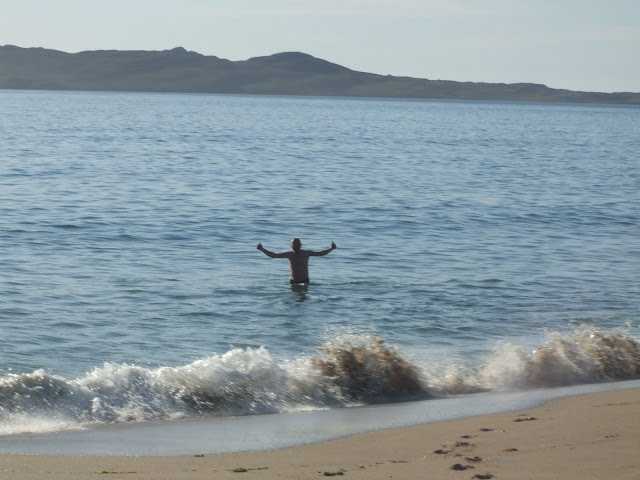
Gradually the road headed west again and back down to a planet earth type landscape, this coast line had many rocky coves with beaches at regular intervals. We stopped at one beach and went for a quick swim (water temp must have been about 8 or 9 degrees C), it was er... refreshing in a sort of taking your breath away type of a way. Some people on the beach gave us some beers so we sat and dried off and enjoyed a beer. Even so it was now 7:30pm and we still had 50 miles or so to get to the B&B in Stornoway.
A quick refreshing swim before heading for Stornoway.
As we made tracks for Stornoway we waved farewell to the folks on the beach. And eventually, with thanks to the GPS we landed at our B&B in the heart of the main City/town of the Outer Hebrides.
In typical style it was after 9:00 pm already as we hastily dropped off our bikes and luggage at the B&B then even more hastily headed for a restaurant. The last thing we wanted was a repeat of the previous evenings meal (2 bags of crisps) as we hadn't eaten since our Scottish breakfast early in the morning.
We were in luck, although it was 30 minutes after last serving time the chef agreed to fit us in.... ..thanks chef.
We ate our meal and had a couple of pints of ale as we discussed what to do tomorrow. We decided to try and fit in a visit to the 5000 year old stone circle near to the western coast line.
Day 3
After a bad night's sleep due to loads of chav's racing their Subaru Impetsas and hot hatches round and round Stornoway all night long, I went to the dining room and had a superb breakfast. In passing I asked the proprietors husband why do the cars beep their horns every time they pass the B&B all night long, he said it was 'an Island thing'. His wife then proceeded to ask each and every other guest in the dining room if they had been disturbed by the noise of cars during the night... one by one they all said they had slept like logs.. made me look like a right complaining git. Anyway she phoned the local constabulary and reported the rowdiness as it seems to be a regular thing.
Preparing to leave the B&B
We had tickets for the ferry for about mid day, so we had to make tracks in order to get to the 5000 year old stone circle before our sailing.
We loaded the panniers back onto the bikes and set off for the west coast of the island in the general direction of the stone circle.
On the way across the island we encountered some sereous road works and found ourselves on new roads that were unknown to the GPS. We duly followed a sign saying 'scenic route'. This took us off on a meandering coastal road and true to form it was very scenic.
Also true to form we stopped frequently to take photo's of boats, cows, beaches and seas etc.
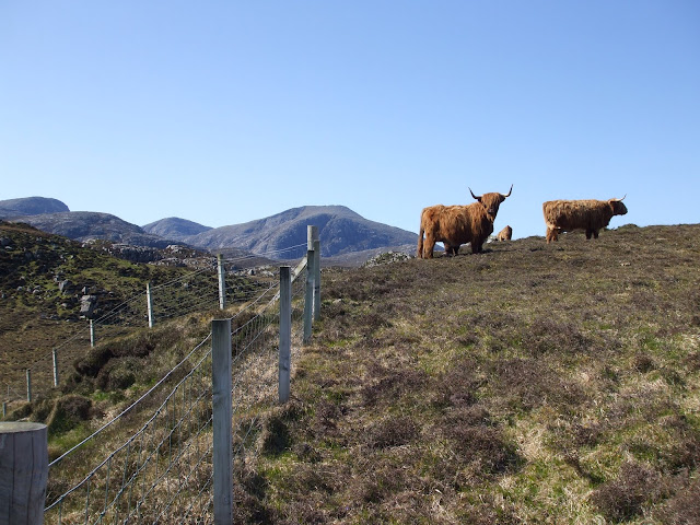 |
| A bunch of Scottish cows |
 |
| En-route for the western shore of the Isle of Lewis |
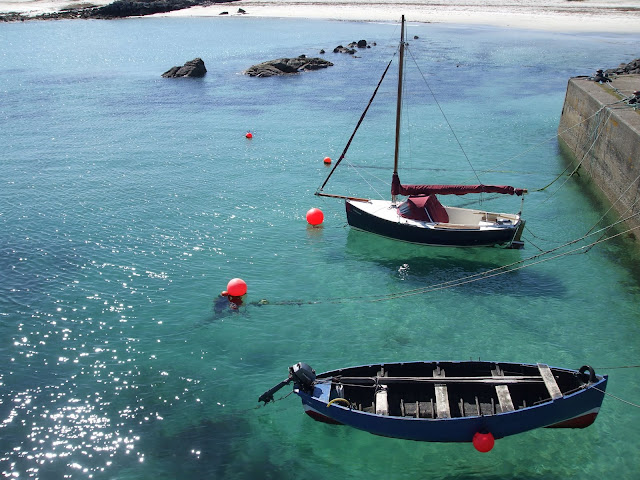 |
| Boats moored and anchored (cant recall the name of the place) western Lewis |
 |
| Another deserted beach, West of Lewis |
Enough photo's for now, time to head back to Stornaway for the ferry to the mainland.We got stuck in the roadworks again on the way back but we still made it in plenty of time and got to the head of the queue with the bikes, as they had to be loaded first.
The ferry still hadn't arrived so leaving the bikes at the terminal it gave us time to walk into town for some fish & chips.
When we got back there was another biker there who lived in Stornoway, he was going back to the mainland then south to Stranraer to catch another ferry to Northern Ireland as he was going to see the NW 200 road races.
Eventually the ferry arrived and we said farewell to Stornoway and the Outer Hebrides.
Farewell to Stornoway & the Outer Hebrides
It was a three hour sailing to Ullapool in NW Scotland, I stayed indoors on the ferry and grabbed 40 winks. Incidentally this was the 3rd consecutive day of continuous sunshine and it was way beyond our expectations.
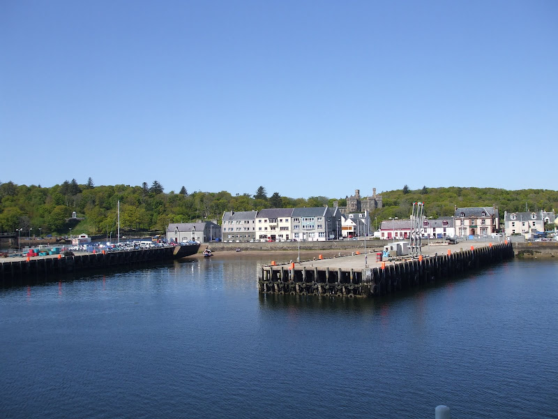
After the three hour crossing we disembarked at Ullapool and duly found a place to fill up the bikes as we didn't fancy a repeat of our last trip to Scotland when we ran out of fuel.
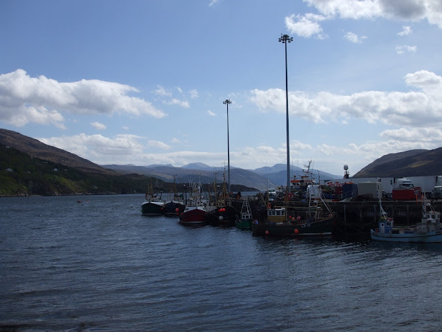
Boats at Ullapool
 |
| Stunning scenery NW of Ullapool |
Although the roads are extremely narrow here, the scenery is well worth the extra time required to get there.
 |
| Not fast roads, but well worth the view |
As crazy as it sounds we were falling into the trap of stopping too often, the scenery around every turn is stunning. A bike mounted auto shoot camera might be an invention to seek out for the next visit up here.
We eventually wound our way around the stoer peninsular and made it back onto the main road further north, which was completely deserted. We swooshed norwards along the deserted roads and eventually cranked over we crossed the unusual curving Kylesku bridge and continued north. Then a while later Laxford bridge came into view (this was the furthest north we had ever been which was back in 2007. We crossed the bridge and onwards we went....... heading for a place called Kinlochbervie.
We had initially wanted to go to a place called Cape Wrath (most north western point on the mainland) but during the planning stages we discovered that you can only reach this place on foot by means of a ferry journey across a river. Further more there were large scale military Land, Sea and Air exercises taking place there at the time we would be there. Needless to say we adjusted our plan for the nearest point to this, which we deemed to be Kinlochbervie. We will try and get to Cape Wrath on some future trip maybe as it hosts the tallest sea cliffs in Britain which must surely be worth a look.
After travelling and stopping many times we eventually arrived at the B&B/restaurant at Kinlochbervie and once again it was 9:00pm.... the time just flies in Scotland.
As nobody was on the reception desk we went through a near by door and into what we instantly realised was a busy dining room. Everyone stopped eating and stared at us as if we were some strange creatures just arrived from Roswell (admittedly we did have our motorcycling gear on). We were only just in time to order food, which was just as well as the food here was excellent.
B&B at Kinlochbervie
Day 4
The following day we continued to the north and followed the northern coast road around Tongue bay
shortly after this we took off at a tangent and headed back inland and heading due south along a narrow tarmac road which had grass growing through along the centre line. It meandered along for miles past a few distinct mountains or Ben's as they are known in this part of the world. Eventually we stopped at a 3000 year old circular stone structure
 |
| The road skirts around Tongue Bay |
shortly after this we took off at a tangent and headed back inland and heading due south along a narrow tarmac road which had grass growing through along the centre line. It meandered along for miles past a few distinct mountains or Ben's as they are known in this part of the world. Eventually we stopped at a 3000 year old circular stone structure

Dun Dornaigil Broch (situated just south of Loch Hope)
When we left here we swapped bikes just for a bit of a change. I took the Tiger which I found to be very comfy.
The road now followed the general direction of a stream / Naver river, the road was deserted so we could make good progress too.


After quite a few miles 30 or 40? we spotted a suspension foot bridge crossing the river so we stopped to investigate.

The sign on the bridge stated 'exclusively for the use of the Naver River fishermen'. Ah well, the bridge looked more like Galloping Guerty as we crossed it. It crossed over onto an island that had been created by the river dividing into two at this point, across the other side of the island was another similar bridge that went across to the far side of the river. Made a bit of a break from the constant travelling... but as always it was good to get back on the bikes again and continue our journey that would bring us out on the far north coast road near to John O Groats.
Even though the day had clouded over slightly and the temp had dropped quite a bit, it was still dry and good to be out on the bikes. Being so close to JOG we headed there first to tick it off the list of places to visit. It was a more deserted place than what I was expecting.
Naturally we managed to find a place for a bite to eat and a cup of coffee then take a few photo's before heading further eastwards to the most north easterly point on the mainland. This was a lighthouse at Duncansby head... more photo's then off to find the B&B.

The B&B was chosen because it was located at the most northern point on mainland Britain at a place called Dunnett head, however... before going there we spotted what appeared to be a narrow track leading down the face of the cliff down towards the beach/seashore? Naturally being inquisitive we followed this and arrived in a small rocky bay at the foot of the cliffs. There was a couple of long ago derelict buildings there along with a sloping stone built boat ramp leading out into the bay. We parked up at the top of the ramp, then went off to explore the area.
The tide was out so there were quite a few rock pools to see and even a couple of rock caves. We could see a number of buildings at the tops of the cliffs and we later discovered that one of them was our B&B.
The B&B was quite run down compared to the others we had stayed at but OK ish and at least we had a garage to park the bikes, there was also plenty of tourist guides and stuff available. We soon realised that we hadn't even scratched the surface on the list of things to see and do in Scotland. By far the biggest down fall regarding the B&B.... it wasn't within walking distance of a pub or restaurant. Ah well we got cleaned up then went out on the bikes to an eatery for our supper about 4 miles away. This was a large pub that sold good grub. We got talking to a couple who were over from Tasmania, they were a good laugh and the guy used to go to the WSB racing on Phillip Island.
I really could have done with more than a couple of beers but the journey back to the B&B prevented that.
The following morning I was up and out by 6:00am walking along the cliff tops... it was spectacular, the sea below was like a mill pond. I phoned Sandra to let her know where we were and to say Nah nah na nah naa or words to that effect. I even took a few photos on the phone.
The road now followed the general direction of a stream / Naver river, the road was deserted so we could make good progress too.
After quite a few miles 30 or 40? we spotted a suspension foot bridge crossing the river so we stopped to investigate.
Bridge over the Naver river
Even though the day had clouded over slightly and the temp had dropped quite a bit, it was still dry and good to be out on the bikes. Being so close to JOG we headed there first to tick it off the list of places to visit. It was a more deserted place than what I was expecting.
 |
| The sign says it all |
Naturally we managed to find a place for a bite to eat and a cup of coffee then take a few photo's before heading further eastwards to the most north easterly point on the mainland. This was a lighthouse at Duncansby head... more photo's then off to find the B&B.
Duncansby Head Light House, more NE than JOG
The B&B was chosen because it was located at the most northern point on mainland Britain at a place called Dunnett head, however... before going there we spotted what appeared to be a narrow track leading down the face of the cliff down towards the beach/seashore? Naturally being inquisitive we followed this and arrived in a small rocky bay at the foot of the cliffs. There was a couple of long ago derelict buildings there along with a sloping stone built boat ramp leading out into the bay. We parked up at the top of the ramp, then went off to explore the area.
 |
| Near to Dunnet Head, the most northerly point on the mainland |
The tide was out so there were quite a few rock pools to see and even a couple of rock caves. We could see a number of buildings at the tops of the cliffs and we later discovered that one of them was our B&B.
The B&B was quite run down compared to the others we had stayed at but OK ish and at least we had a garage to park the bikes, there was also plenty of tourist guides and stuff available. We soon realised that we hadn't even scratched the surface on the list of things to see and do in Scotland. By far the biggest down fall regarding the B&B.... it wasn't within walking distance of a pub or restaurant. Ah well we got cleaned up then went out on the bikes to an eatery for our supper about 4 miles away. This was a large pub that sold good grub. We got talking to a couple who were over from Tasmania, they were a good laugh and the guy used to go to the WSB racing on Phillip Island.
I really could have done with more than a couple of beers but the journey back to the B&B prevented that.
The following morning I was up and out by 6:00am walking along the cliff tops... it was spectacular, the sea below was like a mill pond. I phoned Sandra to let her know where we were and to say Nah nah na nah naa or words to that effect. I even took a few photos on the phone.
Day 5
The plan today was to fathom out an interesting route to eventually take us to Fort Augustus down at Loch Ness.... and what a fantastic, interesting and long winded route it turned out to be. But first things first we enjoyed the full Scotish breakfast that had been placed before us.
That done we paid our bill and walked to the garage where our bikes stood (we had already loaded them up before breakfast). We couldn't wait to get on the move again, even though we were now starting the 2 day journey back home.
We got onto the main road (A836) and headed as due west as it would allow, what a fast road that is. There was quite a strong gusting wind as we headed west and it was decidedly cooler than it had been for the previous days of our trip, but most importantly it was still dry. We roared past the town of Thurso which is a large sea side town right on the northern coastline. Then about 12 miles past there we took a 90 degree left turn and headed due south heading along the A897.... there is no such thing as a bad road in Scotland. This road twisted,turned and undulated us along to the village of Kinbrace where we eventually turned off with the aid of a right turn.
Onto another meandering route, taking us back up in a N westerly direction. We passed by mountains, lochs and forests as we swooshed our way along heading for Altnaharra and then due south once again heading towards Lairg, the roads were virtually deserted bar for the occasional logging truck. Incidentally if you are ever asked 'when does a logging truck have right of way' the answer is ALWAYS.
We stopped at some small settlement next to a loch and had a quick cold drink and an ice cream. A bunch of about a dozen German bikers passed by heading in the opposite direction, naturally they all waved as they passed by. There seems to be a sense of contentment, a real feel good factor as you travel these roads.
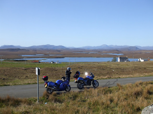
Ah well, onward ever onwards we continued to Lairg where we stopped again to establish where to head for next. We did have a gps but deliberately avoided entering our final destination for the day as we wanted to go via a quirky interesting type route that would take in Applecross amongst other places so we decided upon the dot to dot method of route planning.
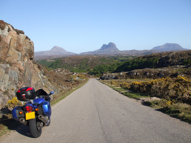
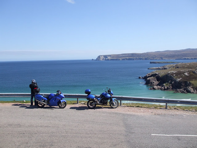
From Lairg we decided to head for the western coast and then southwards to Ullapool. This was the port we docked at when we came over from the Outer Hebredes a couple of days ago. There are quite a few 900 mtr high peaks in the area which are amazingly picturesque... don't know why but my camera never see's what I see so I have to work closely with the laws of probability ie: take LOTS of photo's and there will possibly be one good one.
Heading for Applecross we went over the steep side Bealach na Ba first.

This is the view from the top. Across the short expanse of water is The Isle of Skye
eventually we stopped at the pub on the coastline at Applecross and ordered a couple of pints of ice cold shandy, after which we took up residence at one of the bench tables in the beer garden directly beside the sea. We had to squint against the powerful sunlight as we took in the scene beyond our condensation coated glasses...... Utopia just about summed it up.
That done we paid our bill and walked to the garage where our bikes stood (we had already loaded them up before breakfast). We couldn't wait to get on the move again, even though we were now starting the 2 day journey back home.
We got onto the main road (A836) and headed as due west as it would allow, what a fast road that is. There was quite a strong gusting wind as we headed west and it was decidedly cooler than it had been for the previous days of our trip, but most importantly it was still dry. We roared past the town of Thurso which is a large sea side town right on the northern coastline. Then about 12 miles past there we took a 90 degree left turn and headed due south heading along the A897.... there is no such thing as a bad road in Scotland. This road twisted,turned and undulated us along to the village of Kinbrace where we eventually turned off with the aid of a right turn.
Onto another meandering route, taking us back up in a N westerly direction. We passed by mountains, lochs and forests as we swooshed our way along heading for Altnaharra and then due south once again heading towards Lairg, the roads were virtually deserted bar for the occasional logging truck. Incidentally if you are ever asked 'when does a logging truck have right of way' the answer is ALWAYS.
We stopped at some small settlement next to a loch and had a quick cold drink and an ice cream. A bunch of about a dozen German bikers passed by heading in the opposite direction, naturally they all waved as they passed by. There seems to be a sense of contentment, a real feel good factor as you travel these roads.
Ah well, onward ever onwards we continued to Lairg where we stopped again to establish where to head for next. We did have a gps but deliberately avoided entering our final destination for the day as we wanted to go via a quirky interesting type route that would take in Applecross amongst other places so we decided upon the dot to dot method of route planning.
From Lairg we decided to head for the western coast and then southwards to Ullapool. This was the port we docked at when we came over from the Outer Hebredes a couple of days ago. There are quite a few 900 mtr high peaks in the area which are amazingly picturesque... don't know why but my camera never see's what I see so I have to work closely with the laws of probability ie: take LOTS of photo's and there will possibly be one good one.
Heading for Applecross we went over the steep side Bealach na Ba first.
This is the view from the top. Across the short expanse of water is The Isle of Skye
eventually we stopped at the pub on the coastline at Applecross and ordered a couple of pints of ice cold shandy, after which we took up residence at one of the bench tables in the beer garden directly beside the sea. We had to squint against the powerful sunlight as we took in the scene beyond our condensation coated glasses...... Utopia just about summed it up.
 |
| Beer garden/beech at Applecross |
On an ordinary day it was the sort of place where you could relax for a couple of hours or more..... but this was the penultimate day of our trip and we still had hundreds of sites and places to see...... not to mention the miles still to cover and that was just to get us to Fort Augustus. Reluctantly we finished our refreshments and donned our clobber once more.
We made an absolute point of topping our tanks up before leaving Applecross as this (between Applecross and Ullapool) is where we came unstuck on our last trip 2 years earlier. The coastline north was the route we took, it was late afternoon/early evening and the traffic seemed to be even more sparse.
The sequence of endless narrow twisting and undulating roads drew us in like a black hole and eventually spat us out onto a calm wide empty bridge.
As we looked to the right, the Castle Eilean Dunon (as seen on Scottish shortbread and biscuit tin lids everywhere) loomed and as always it just seemed to be floating on the loch as if it were a mirage. I can't imagine anyone ever passing this place without stopping....... we parked the bikes at the top of a boat ramp and quickly grabbed the cameras. True to form I took dozens of identical pictures..... here's one of them:-
 |
| The epitome of Scotland, Eileen Dunon |
After this pilgrimage the magnificent smooth A87 beckoned as the time now was prob approaching 8:00pm, we progressed onwards at quite a speed, the road was almost devoid of other traffic just like the preveous narrow twisty roads from Applecross. But in complete contrast this road was very wide and the exits to bends could almost always be seen prior to entering. This one run really was a fantastic memorable stint of motorcycling for me, maybe it was partly fuelled by the sights we had just taken in or possibly even the meal that awaited at the pub at Fort Augustus (yes I am a bit of a glutton lol)???
Eventually we arrived at Loch Ness then onwards to Fort Augustus at the Southern end where we checked into the B&B, dropped off our motorcycling apparrel and quickly headed for food and drink at a near by pub. As always we were pushing it a bit with the time as to whether we would be served food or not. Fortunately we were in time.
We enjoyed a couple of pints and recapped our days riding with plenty of laughs, tomorrow would be the final journey home.
Day 6
Another hearty breakfast served by Trish at the B&B, the skies outside looked grey, black and forboding.... although in fairness it wasn't raining at that moment.
Having viewed the likely weather prospects we discussed the route for the homeward leg and decided upon the Roman option.... that being the shortest distance between two points etc.
After settling our bill and thanking Trish for the Breakfast we loaded the bikes for the last time and set off homeward bound along the A82. It wasn't long before we had to stop and don our waterproof's but that didn't bother us one little bit.
We continued ever onwards, passing numerous and nameless Loch's, mountains and forrests as we went. The Statues of the Commando's gazing out towards Ben Nevis came into view and passed us by on the right, splendid though it was, we resisted the urge to stop this time around and continued on.
A while later we crossed over a large steel girder type bridge, sort of like an inverted arch in profile. I pondered the design momentarily as we crossed. I was later informed that it was the Spean Bridge but have since found that not to be the case. So it still remains an un named bridge on our travels.
Fort William eventually arrived infront of us and we weaved our way through this town that could easily be described as a hub where every spoke takes you to a different part of motorcycling Utopia. Yeah I know a bit rich maybe but in actual fact every way you could aim your motorcycle from here is such that the journey itself could well be the destination.
We had previously decided to pass through Fort William and stop once again at the Pit Stop Diner situated on Loch Long quite a few miles the other side of Fort William.
We eventually arrived and discovered the diner was closed although the take away window was open. Mind you seeing as we had mistakenly entered the place through the diner door and sat down the propriotor reluctantly agreed to let us stay in there and enjoy a good 2 course meal plus drinks.

The last photo of the trip. Parking up before walking through the door of the Diner
Meals consumed we refuelled the bikes yet again then headed for the open road once more, meandering our way back towards the A82 and then due south along it.
Clad in our waterproofs we made good progress as we sped through Glencoe. Which by the way, was the last truly awesome sight of the trip. From that point onwards the splendour of the scenery gradually morphs back into that which we call home some two or three hundred miles further south.
Finally back onto the motorway network and in the pouring rains we continued along in the company of a GS1200 BMW rider. Back into England we went and eventually came the ubiquitis stop off at the Tbay services for a final coffee, a bite to eat and a recap of the full weeks tour....... in summary..
We had just enjoyed 6 full days of glorious sunshine in the most spectacular surroundings imaginable riding motorcycles....